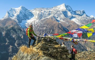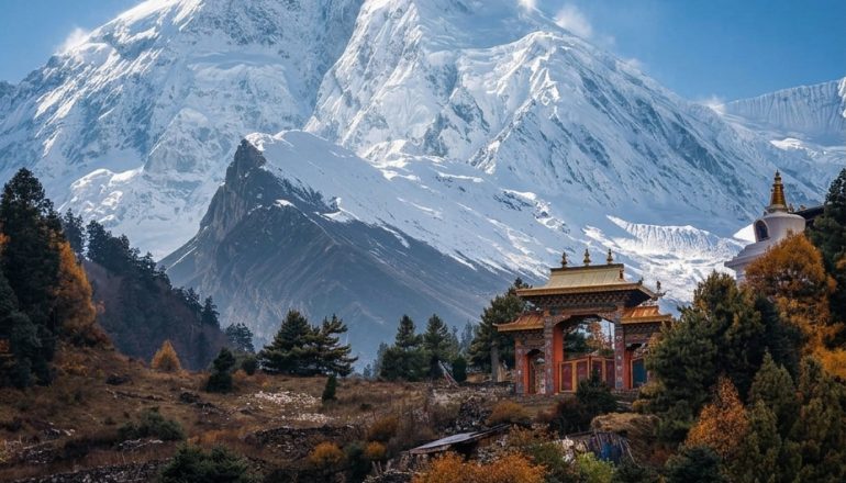
Manaslu is the trek people take when they want Everest-level scenery without Everest-level crowds. The circuit loops around the world’s eighth-highest mountain through forested lower valleys, high alpine desert, and Tibetan-influenced villages, crossing the Larkya La at 5,106 meters before dropping into the Annapurna region. It’s remote, it’s regulated, and right now it’s also affected by flood damage you should know about before you book. Here’s the full picture.
What makes the Manaslu region worth trekking
The draw is the range packed into one trek. You start in subtropical river valleys, thick with rice terraces and waterfalls, and finish above the treeline in landscape that looks and feels like Tibet, because culturally, in the upper villages, it largely is. Samagaon and Samdo sit close enough to the old salt-trading routes into Tibet that the architecture, the monasteries, and the language shift noticeably as you climb.
Unlike Everest Base Camp or the classic Annapurna Circuit, Manaslu is a restricted area, which caps how many people are on the trail at any given time. You’ll share teahouses with other trekkers, but nothing like the queues at Everest Base Camp in peak season.
Is the Manaslu Circuit good for beginners?
It’s doable for a fit first-timer, but it’s not a beginner’s easiest option. The trek runs 14 to 18 days depending on itinerary, with several long days in a row above 3,500 meters and one genuinely demanding pass day at Larkya La. A longer itinerary buys more acclimatization time and a gentler pace; a shorter one means longer walking days with less room to adjust. What makes the trek more approachable than it sounds is the mandatory guide: you’re never navigating or making altitude calls alone, which takes a lot of the risk out of a first big trek.
If you’re new to multi-day trekking, the honest prep list is basic aerobic fitness (you should be comfortable hiking five to seven hours on consecutive days before you go), some experience with stairs or hills carrying a daypack, and a real acclimatization plan rather than pushing through headaches. People without prior Himalayan trekking experience do complete Manaslu regularly. They just tend to do it on the longer end of the itinerary range.
Route overview: how the trek unfolds
The trek starts with a drive from Kathmandu to Machha Khola or Soti Khola, then follows the Budhi Gandaki River upstream. The first several days move through forest and farmland, past Jagat and Deng, gaining altitude gradually. Namrung marks roughly the halfway point and the shift into higher, drier terrain. From there the trail climbs through Lho and Samagaon, both good acclimatization stops with clear views of Manaslu itself, then on to Samdo, the last real village before the pass.
Larkya La, the trek’s highest point at 5,106 meters, comes after a night at Dharamsala or Larke Phedi: a long, cold, early start over the pass, dropping down the other side into Bimthang and eventually Dharapani, where the route joins the Annapurna Circuit trail for the final stretch out.
Nepal’s First Cantilever Bridge
One of the interesting landmarks along the Manaslu Circuit is Nepal’s first cantilever bridge, located along the route toward the Manaslu region. The bridge uses a cantilever design, allowing it to extend across the gorge without traditional support structures beneath the main span. It adds a unique engineering feature to the trek while connecting remote settlements across the rugged Himalayan landscape.
For trekkers, crossing the bridge is also part of the experience of the Manaslu Circuit, offering views of the surrounding valleys, rivers, and steep mountain terrain.
Major attractions along the Manaslu Circuit
- Mount Manaslu views — dominates the skyline for days, best from Samagaon and the side trip to Manaslu Base Camp, close enough to watch avalanches off the north face on a clear morning
- Pungyen Gompa — a quiet monastery detour above Samagaon, sitting almost directly under the mountain with far less foot traffic than the base camp trail
- Lho village and monastery — one of the best-framed monastery views on the route, with Manaslu rising right behind it
- Samagaon and Samdo — Tibetan-influenced villages in architecture, dress, and daily life, settled generations ago along the old salt-trade route into Tibet
- Ribung Gompa and the mani walls — scattered through the upper villages, worth slowing down for
- Larkya La (5,106m) — the trek’s high point, opening onto Annapurna II, Himlung, and Cheo Himal in one sweep
- Bimthang — a quiet, glacier-fed valley just below the pass, often rushed through but worth a slower afternoon
Difficulty, distance, and altitude
Most days run five to seven hours of walking, longer on the pass-crossing day, which can run eight to ten hours depending on conditions. Total elevation gain over the trek is substantial, several thousand meters cumulatively, but spread over enough days that a sensible itinerary builds in proper acclimatization rather than rushing the ascent.
The trail itself is well-established and doesn’t require technical skill, no ropes or scrambling, but expect narrow sections, suspension bridges, and, this season in particular, some stretches that have seen flood or landslide damage and may involve temporary crossings. A good guide will know the current state of the trail day to day.
Watch for the usual altitude sickness signs as you climb: headaches, dizziness, unusual tiredness, nausea, or trouble sleeping. Tell your guide as soon as something feels off rather than pushing on to see if it passes; that’s exactly the judgment call they’re there for.
Permits and the guide requirement
Manaslu requires three permits (the Restricted Area Permit, the Manaslu Conservation Area Permit, and the Annapurna Conservation Area Permit for the final stretch), all processed through a registered trekking agency, and a licensed guide is mandatory for the entire route. There’s no independent, unguided version of this trek for any nationality.
Total cost depends on itinerary length, group size, season, and how much of the trek you’re doing privately versus as part of a group departure. Ask your agency for an itemized price covering permits, transport, guide and porter fees, accommodation, and meals before you book, rather than a single bundled number. For the full breakdown and a season-by-season budget, see our dedicated Manaslu Circuit Trek cost guide.
Best time to trek the Manaslu region
Autumn (September to November) and spring (March to May) are the reliable windows, with stable weather and the clearest mountain views. Winter brings real cold and a real chance the pass is snowed in or closed. Monsoon, June through September, is the riskiest window for exactly the kind of flooding and landslide activity the region has seen this year, on top of the usual leeches and washed-out lower trail sections.
Accommodation and food on the trail
Teahouses run the length of the route, simple but functional, with rooms priced low on the understanding that you’ll eat your meals at the same lodge. Expect dal bhat, noodles, soup, and simpler options the higher you climb, with prices rising with altitude since everything has to be carried in. Hot showers, charging, and Wi-Fi are available at many stops for a small extra fee, less reliably above Samagaon.
What to pack
Layering matters more than any single piece of gear: warm days in the lower valleys give way to genuinely cold nights above 3,500 meters. A sleeping bag rated to around -15°C, a good down jacket, waterproof shell, and solid broken-in boots cover the essentials. Trekking poles help a lot on the descent from Larkya La. Most of this is rentable in Kathmandu’s Thamel district if you don’t want to buy gear you’ll use once.
Tsum Valley and other add-ons
Tsum Valley branches off the main Manaslu trail and is worth considering if you have extra time, a quieter, more culturally distinct side valley with its own permit requirement, often combined with the main circuit into a longer, three-to-four-week itinerary. Note that Tsum Valley’s approach shares some of the same lower trail as the main circuit, so it’s subject to the same current access issues around Chumnubri.
Frequently asked questions
Is the Manaslu Circuit Trek currently open?
The Manaslu Circuit has been affected by flood damage in 2026. Trail conditions and official reopening status can change, so check with your trekking operator before booking or starting the trek.
Can beginners do the Manaslu Circuit Trek?
Yes, fit beginners can complete the trek with proper preparation and acclimatization. A longer itinerary is generally more suitable for first-time Himalayan trekkers.
How long does the Manaslu Circuit Trek take?
Most Manaslu Circuit itineraries take around 14 to 18 days, depending on the route, acclimatization days, transportation, and additional side trips.
Do I need a guide for the Manaslu Circuit Trek?
Yes. A licensed guide is mandatory for the Manaslu Circuit, and the trek must be arranged through a registered trekking agency.
What is the highest point of the Manaslu Circuit Trek?
The highest point is Larkya La Pass, which stands at 5,106 meters above sea level.